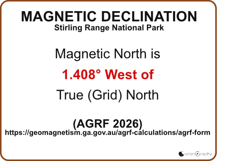
The magnetic needle is the only moving part of the compass that automatically aligns itself with the Earth's magnetic field.
The red end of the needle always points towards Magnetic North.
Unlike the rotating bezel, you cannot position the magnetic needle by turning the compass housing. The bezel can be rotated to any angle, but the magnetic needle will continue to point north.
This independent movement is what makes the compass work. As you rotate the compass or the bezel, the needle continues to align with magnetic north.
When using the compass, your objective is to rotate the bezel until the red magnetic needle sits directly inside the red orienting arrow, often remembered as "Red in the Shed." Once the needle is correctly aligned, you can read or follow the bearing indicated at the Index Marker.
Because the magnetic needle responds to the Earth's magnetic field, it can be affected by nearby metal objects, magnets and electronic devices. Always keep these away from your compass when taking a bearing.
Section 3. Magnetic needle
Magnetic Needle Deep Dive
Different Types of North
When learning to navigate, you'll come across three different types of north. Although they are closely related, they are not exactly the same.
Magnetic North
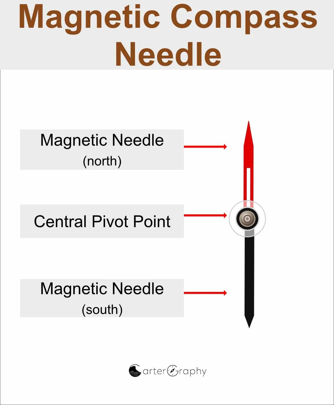
Magnetic north is the direction your compass needle points. It is determined by the Earth's magnetic field rather than the North Pole itself.
Because the Earth's magnetic field slowly changes over time, magnetic north is continually moving. As a result, magnetic declination also changes gradually.
Grid North
Grid north is the north shown by the vertical North-South grid lines printed on your map. These are also called Eastings.
On modern Australian topographic maps using the Map Grid of Australia (MGA), the grid is based on the Universal Transverse Mercator (UTM) projection. The grid lines are straight and parallel, making them ideal for measuring bearings and navigating with a compass.
Because your map uses the MGA grid, all of your navigation is carried out using these grid lines for orienting.
True North (for interest)
True north is the direction of the geographic North Pole, where the Earth's axis of rotation meets the surface.
While true north is important in surveying, astronomy and some mapping applications, bushwalkers rarely need to work directly with it. Most practical navigation involves converting between grid north and magnetic north, with true north remaining in the background.
Why does this matter?
Your compass points to magnetic north, while your map is referenced to grid north.
The small angle between them is called magnetic declination. Understanding this relationship allows you to convert between map bearings and compass bearings whenever necessary.
Why Doesn't the Map Use True North?
This is where maps become a little clever.
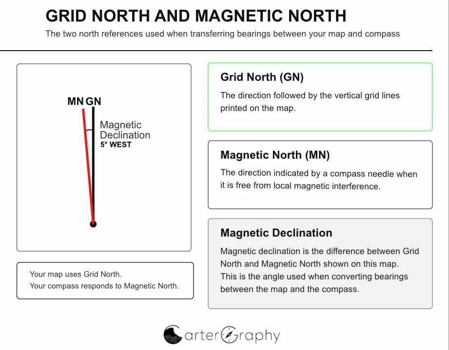
The Earth is curved, but a paper map is flat. To represent a curved surface on a flat sheet of paper, cartographers use map projections. In Australia, topographic maps use the Map Grid of Australia (MGA), which is based on the Universal Transverse Mercator (UTM) projection.
Rather than using lines that converge towards the geographic North Pole, the map is covered with a rectangular grid of evenly spaced eastings and northings. The vertical grid lines all point towards grid north.
This makes navigation much simpler. Distances can be measured accurately, grid references are easy to calculate, and bearings can be transferred with a compass using straight grid lines.
The difference between true north and grid north is usually very small over the area covered by a topographic map. For most bushwalkers, it is of little practical significance.
The important relationship for practical navigation is between Grid North, which your map uses, and Magnetic North, which your compass uses. Strictly speaking, magnetic declination is the angle between True North and Magnetic North, while the angle between Grid North and Magnetic North is called the Grid Magnetic Angle. Because map bearings are measured from Grid North, the Grid Magnetic Angle is the correction that matters when converting between a bearing taken from the map and a bearing followed with a compass. For simplicity, this guide refers to this correction as magnetic declination.
Magnetic Declination Across Australia
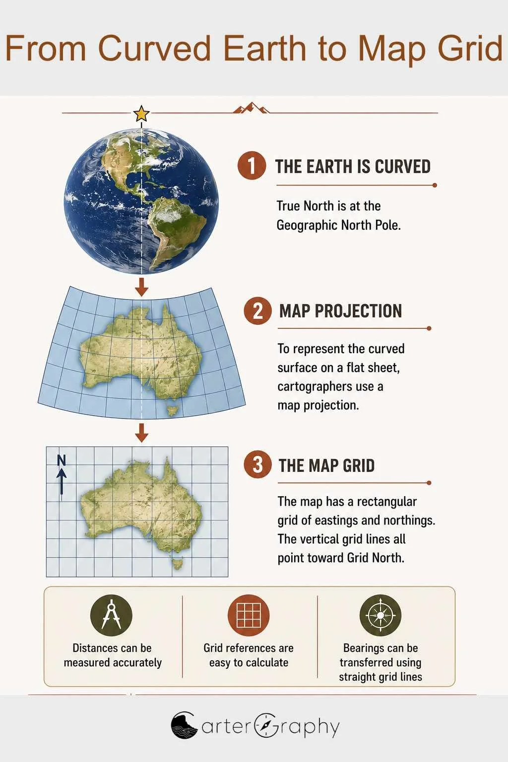
The Stirling Ridge Walk lies in south western Australia, where the magnetic declination is currently(2026),only about 1.4° west. This is one of the smallest magnetic declinations found anywhere in Australia.
As you travel east across the country, the difference between Grid North and Magnetic North becomes much greater. In many parts of central and eastern Australia, magnetic declination is east of Grid North and may exceed 10°. In these areas, applying the correct magnetic declination becomes much more important, particularly when navigating over long distances or in featureless terrain.
For this reason, it is good practice to understand why magnetic declination exists and how to adjust for it. Although the correction required on the Stirling Ridge Walk is small, I prefer to apply it rather than ignore it. Even a one-degree difference can produce a meaningful error over distance, particularly when taking or plotting precise bearings. The significance of this will be demonstrated later in the guide.
Remember that the direction of the correction depends on where you are in Australia. In much of Western Australia, Magnetic North lies west of Grid North, while across most of the rest of Australia, Magnetic North lies east of Grid North. Always check the magnetic declination shown for the area in which you are navigating rather than assuming the same correction applies everywhere.
Did you know?
The line where Magnetic North and Grid North are exactly the same is called the agonic line. Along this imaginary line, magnetic declination is 0°, so no compass correction is required. The agonic line slowly moves over time as the Earth's magnetic field changes, and it currently passes through parts of Western Australia. As a result, south western Australia has one of the smallest magnetic declinations anywhere in the country